Definition Type: Element
Name: ProjectedCRS
Namespace: http://www.opengis.net/gml/3.2
Type: gml:ProjectedCRSType
Containing Schema: coordinateReferenceSystems.xsd
Abstract
Documentation:
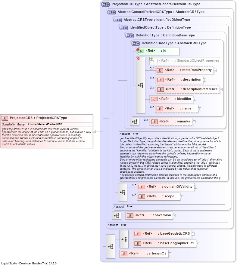
gml:ProjectedCRS is a 2D coordinate reference system used to approximate the shape of the earth on a planar surface, but in such a way that the distortion that is inherent to the approximation is carefully controlled and known. Distortion correction is commonly applied to calculated bearings and distances to produce values that are a close match to actual field values.
Collapse XSD Schema Diagram:
Drilldown into cartesianCSDrilldown into baseGeographicCRSDrilldown into baseGeodeticCRSDrilldown into conversionDrilldown into scopeDrilldown into domainOfValidityDrilldown into remarksDrilldown into nameDrilldown into identifierDrilldown into descriptionReferenceDrilldown into descriptionDrilldown into metaDataPropertyDrilldown into StandardObjectPropertiesDrilldown into idDrilldown into DefinitionBaseTypeDrilldown into DefinitionTypeDrilldown into IdentifiedObjectTypeDrilldown into AbstractCRSTypeDrilldown into AbstractGeneralDerivedCRSTypeDrilldown into ProjectedCRSTypeXSD Diagram of ProjectedCRS
Collapse XSD Schema Code:
<element name="ProjectedCRS" type="gml:ProjectedCRSType" substitutionGroup="gml:AbstractGeneralDerivedCRS">
    <annotation>
        <documentation>gml:ProjectedCRS is a 2D coordinate reference system used to approximate the shape of the earth on a planar surface, but in such a way that the distortion that is inherent to the approximation is carefully controlled and known. Distortion correction is commonly applied to calculated bearings and distances to produce values that are a close match to actual field values.</documentation>
    </annotation>
</element>
Collapse Child Elements:
Name Type Min Occurs Max Occurs
metaDataProperty gml:metaDataProperty 0 unbounded
description gml:description 0 (1)
descriptionReference gml:descriptionReference 0 (1)
identifier gml:identifier 0 (1)
name gml:name 0 unbounded
metaDataProperty gml:metaDataProperty 0 unbounded
description gml:description 0 (1)
descriptionReference gml:descriptionReference 0 (1)
identifier gml:identifier (1) (1)
name gml:name 0 unbounded
remarks gml:remarks 0 (1)
domainOfValidity gml:domainOfValidity 0 unbounded
scope gml:scope (1) unbounded
conversion gml:conversion (1) (1)
baseGeodeticCRS gml:baseGeodeticCRS (1) (1)
baseGeographicCRS gml:baseGeographicCRS (1) (1)
cartesianCS gml:cartesianCS (1) (1)
<xs:group> gml:StandardObjectProperties (1) (1)
Collapse Child Attributes:
Name Type Default Value Use
id gml:id Required
Collapse Derivation Tree:
Collapse References:
gml:AbstractGeneralDerivedCRS